
By Sebastian Frost, a mountain guide who has led hiking, climbing and mountain biking trips for three years. These trails are picked from ones I've guided or hiked.
On TrailyMap, our website and app, you'll find more than 100,000 U.S. hiking trails with hiker reviews and ratings on a map, and these eight are Oʻahu's best easy hikes for a first visit. Each is 5 miles round trip or less and reaches a crater rim, a waterfall, a ridge above Honolulu or Pearl Harbor, a whale-watching headland or North Shore surf. Steeper or longer ones are labeled easy–moderate. Storms close trails here, so check Hawaiʻi State Parks notices first.
At a glance
Diamond Head Summit Trail, Diamond Head State Monument · 1.6 mi · easy–moderate · crater rim high above Waikīkī
Mānoa Falls Trail, Mānoa Valley · 1.6 mi · easy · rain forest walk to a tall waterfall
Puʻu ʻŌhiʻa, Mānoa Cliff and Kalawahine Loop, Tantalus · 2.9 mi · easy–moderate · bamboo forest and views over Mānoa and Honolulu
Makapuʻu Point Lighthouse Trail, Kaiwi State Scenic Shoreline · 2.0 mi · easy–moderate · paved path to whales and a lighthouse
Kaʻiwa Ridge Trail (Lanikai Pillboxes), Kailua · 1.8 mi · easy–moderate · sunrise over the Mokulua islets
ʻAiea Loop Trail, Keaīwa Heiau State Recreation Area · 4.8 mi · easy–moderate · forested ridge above Pearl Harbor
Ehukai Pillbox Trail, Sunset Beach · 1.5 mi · easy–moderate · bunker seat above Pipeline's winter surf
Kaʻena Point Trail, Kaʻena Point State Park · 5.0 mi · easy–moderate · flat coast walk to albatross and seals
Quick picks
Best for first-timers: Diamond Head Summit Trail (#1)
Best for kids: Makapuʻu Point Lighthouse Trail (#4)
Best for a dog: ʻAiea Loop Trail (#6)
Best for sunset: Ehukai Pillbox Trail (#7)
1. Diamond Head Summit Trail, Diamond Head State Monument
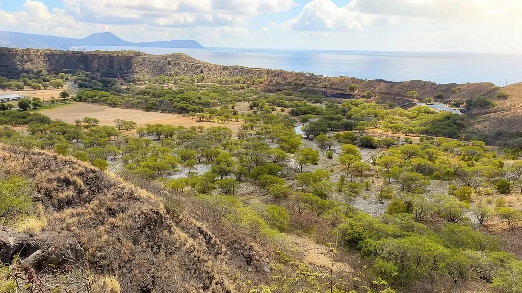
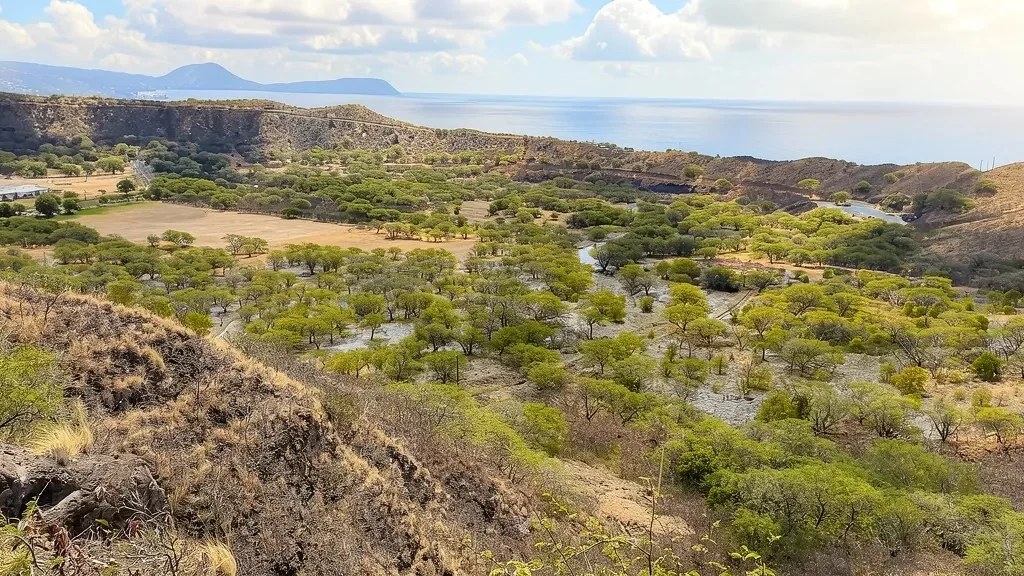
Distance 1.6 mi round trip · Elevation gain 560 ft · Easy–moderate · 1.5–2 h · Best: year-round, early morning · Non-residents: reservation, $5/person + $10/car · Dogs: not allowed
The route climbs the inner wall of Lēʻahi, the crater most visitors call Diamond Head, on a trail built in 1908–1911 for coastal defense. Pavement gives way to switchbacks on natural tuff, steep stairs, a lit 225-foot tunnel and an old fire control station on the rim. From the top you look down on Waikīkī and east toward Koko Head, with humpbacks offshore in winter.
Book the earliest slot. Sunrise slots sell out within hours, and by mid-morning the switchbacks bake.
Good to know: Non-residents book entry and parking on the Hawaiʻi State Parks reservation site (up to 30 days ahead) and must arrive within 30 minutes of the slot start. The park is open 6 a.m.–6 p.m.; last entry is 4:30 p.m.
Map, GPX and directions on TrailyMap →
2. Mānoa Falls Trail, Mānoa Valley
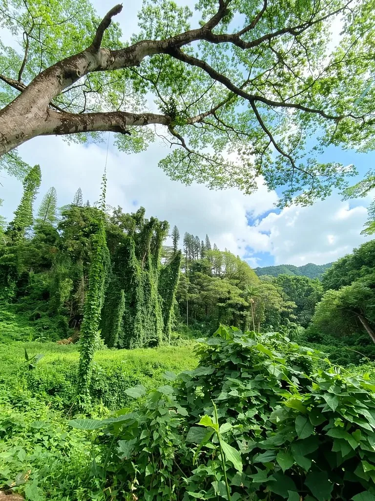
Distance 1.6 mi round trip · Elevation gain about 480 ft · Easy · 1–1.5 h · Best: November–March · Paid trailhead lot or free street parking · Dogs: on leash
Mānoa Road ends a short drive from Waikīkī, and there the city gives way to dripping rain forest. The trail follows the stream uphill under a thick canopy, over roots and rocks, to Mānoa Falls, a narrow ribbon of water more than 100 feet tall sliding down a mossy cliff.
Come on a weekday morning, before the tour groups. The falls run fuller in the wet months, when rain also makes the rocks slick, so wear real shoes, not sandals. Free street parking below adds about a quarter mile each way.
Good to know: No swimming. Stay behind the barrier at the falls; rockfall and leptospirosis are real risks. Skip it during a flood watch, since landslides follow heavy storms.
Map, GPX and directions on TrailyMap →
3. Puʻu ʻŌhiʻa, Mānoa Cliff and Kalawahine Loop, Tantalus
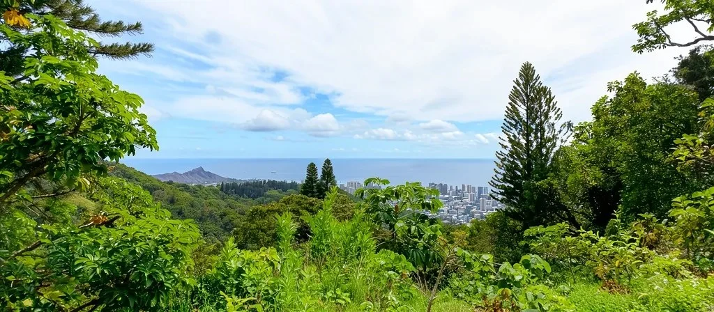
Distance 2.9 mi loop · Elevation gain about 540 ft · Easy–moderate · 2–3 h · Best: year-round, clear mornings · Free; parking near the trailhead on the Tantalus road · Dogs: on leash
High on the road over Tantalus, the Puʻu ʻŌhiʻa Trail climbs on roots and wooden steps through a dense bamboo forest, then follows a short service road past a communications tower on the summit. Beyond a gate into a fenced native forest restoration area, the Mānoa Cliff Trail traces the valley wall, with views down into Mānoa, across to the Koʻolau peaks and back toward Diamond Head. The Kalawahine Trail leads back toward the road.
Pick a clear day; the views depend on it. Expect mud, roots and a few steep drop-offs on the cliff section, so keep small kids close. Close the restoration-area gate behind you; the sign warns of feral pigs.
Good to know: Part of the loop follows Tantalus Drive, which has a narrow shoulder. Leave nothing valuable in the car.
Map, GPX and directions on TrailyMap →
4. Makapuʻu Point Lighthouse Trail, Kaiwi State Scenic Shoreline
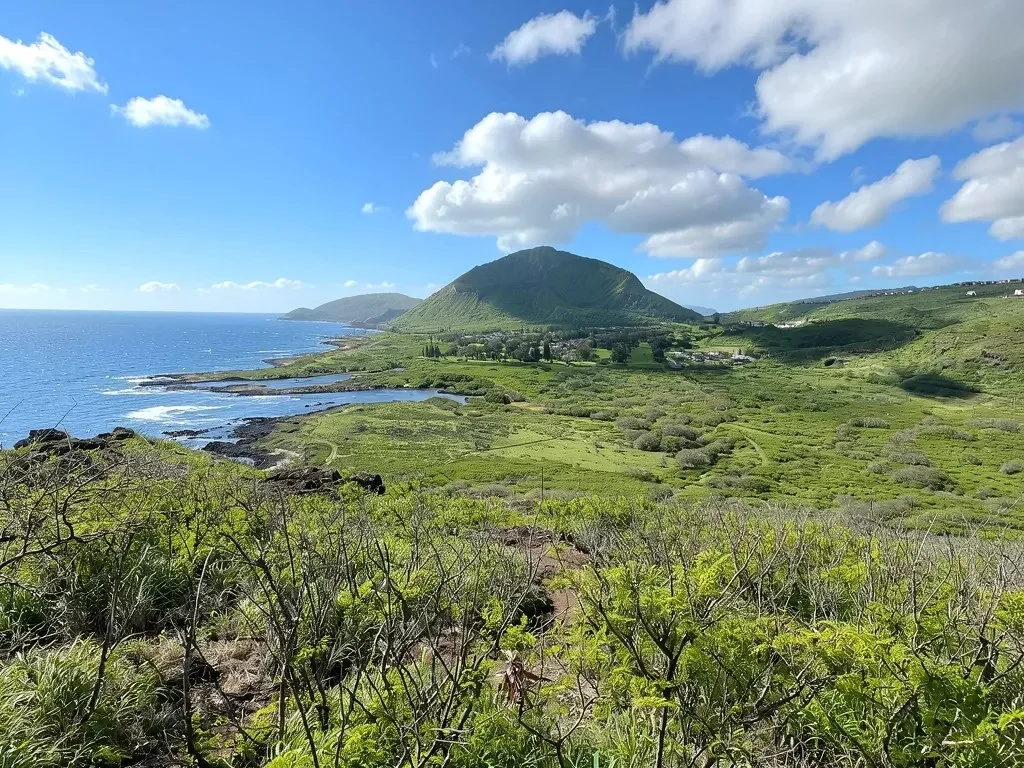
Distance 2.0 mi round trip · Elevation gain 500 ft · Easy–moderate · About 2 h · Best: November–May · No fee; trailhead lot on Route 72 · Dogs: on leash
Pavement makes for easy footing, even if the grade is steady. A service road climbs the dry headland at Oʻahu's eastern tip to a lookout above the red-roofed Makapuʻu Lighthouse, built in 1909. The view takes in the windward coast, two offshore islets that serve as seabird sanctuaries and, on clear days, Molokaʻi and Lānaʻi. From November to May, scan for humpbacks.
There's no shade, so I'd start when the gate opens at 7 a.m. or come late in the day. Bring binoculars, a hat and water; the park has neither water nor restrooms.
Good to know: The lighthouse is off-limits, and the tide pools below are a closed, dangerous area.
Map, GPX and directions on TrailyMap →
5. Kaʻiwa Ridge Trail (Lanikai Pillboxes), Kailua
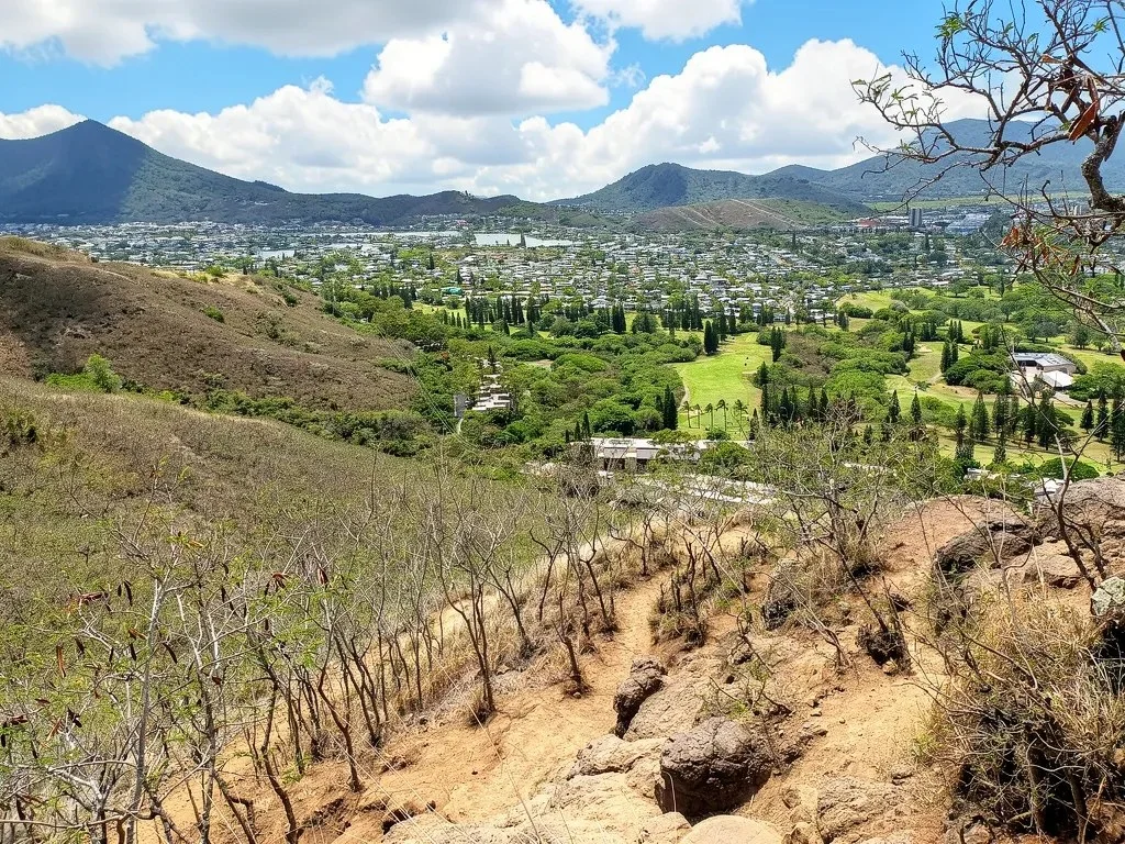
Distance 1.8 mi round trip · Elevation gain 430–690 ft · Easy–moderate · 1–2 h · Best: year-round, dry mornings · Free; street parking only · Dogs: on leash
Short doesn't mean flat. The first stretch is the steepest, packed dirt and loose gravel straight up the ridge, and it turns slick after rain. Then the grade eases, and World War II pillboxes look down on Lanikai Beach, Kailua Bay and the two Mokulua islets, with the Koʻolau cliffs at your back.
The first pillbox, 20 to 30 minutes in, has the classic view and makes a fine turnaround. For sunrise, bring a headlamp. Where gravel rolls underfoot, the grass along the edge often gives steadier footing.
Good to know: There's no lot. Park legally on Aʻalapapa or Kaelepulu Drive, never in the Mid-Pacific Country Club lot or across driveways. People live here, so keep voices and car doors quiet.
Map, GPX and directions on TrailyMap →
6. ʻAiea Loop Trail, Keaīwa Heiau State Recreation Area
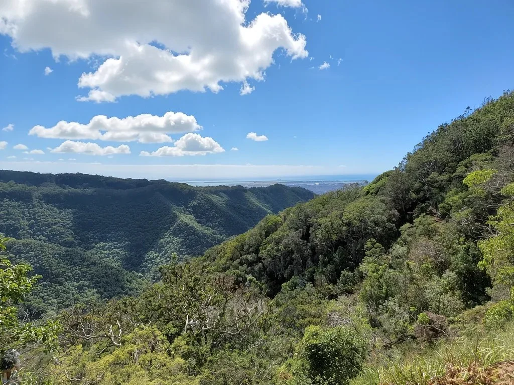
Distance 4.8 mi loop · Elevation gain about 900 ft · Easy–moderate · 2.5–3 h · Best: year-round, after a dry spell · Free; lot at the trailhead · Dogs: on leash (trail only)
From the top of ʻAiea Heights Drive, the loop runs through lemon eucalyptus and Norfolk Island pines along a ridge above Hālawa Valley. Native koa and ʻōhiʻa grow near Puʻu Uau, the high point, and gaps in the trees look over Pearl Harbor (Puʻuloa), the Waiʻanae Range and the coast to Diamond Head. A B-24 bomber crashed here in 1944, though a landslide pushed most of the wreckage out of sight.
Expect gradual climbs, one steep switchback and a stream crossing. Go after a few dry days; it gets very muddy. Before leaving, see Keaīwa Heiau, a healing temple where kahuna treated the sick with forest plants. View it from outside the stone walls.
Good to know: Winter hours are 7 a.m.–6:45 p.m. All park restrooms are closed for construction through Nov. 25, 2026. Dogs may only pass through the park, leashed, to reach the trail.
Map, GPX and directions on TrailyMap →
7. Ehukai Pillbox Trail, Sunset Beach
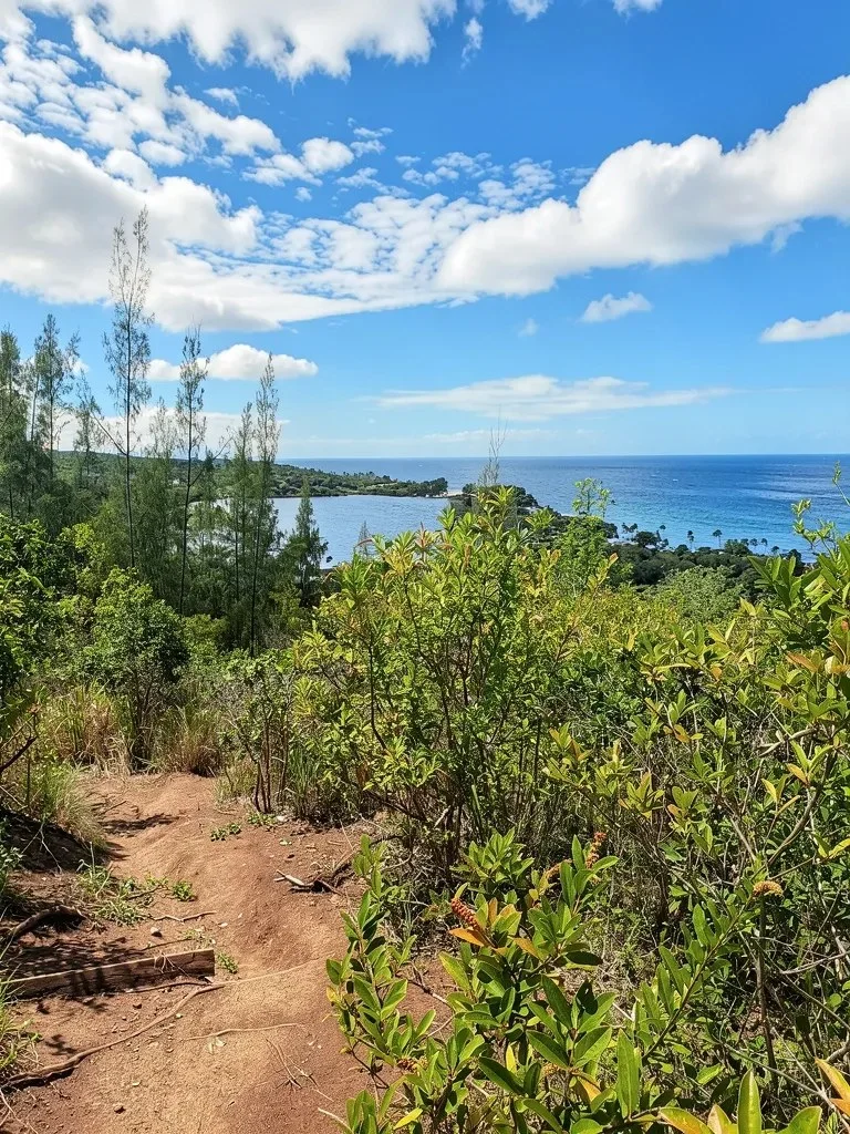
Distance 1.5 mi round trip · Elevation gain about 410–600 ft · Easy–moderate · 1–1.5 h · Best: winter, late afternoon · Free; park lot or roadside · Dogs: check locally
Starting beside Sunset Beach Elementary, this climb gets the hard part done early: a steep, rooty pitch, with ropes in the muddy spots, up to a picnic table and then the first pillbox. From there you look over the Banzai Pipeline and Sunset Beach surf breaks, plus the coast to Turtle Bay and the Waiʻanae Range.
Look for a small orange "Mahalo!" sign left of the school sign. Aim for late-afternoon light, but start well before sunset so you aren't descending a muddy slope in the dark.
Good to know: Stop at the pillboxes. The ridge beyond is posted no trespassing.
Map, GPX and directions on TrailyMap →
8. Kaʻena Point Trail, Kaʻena Point State Park
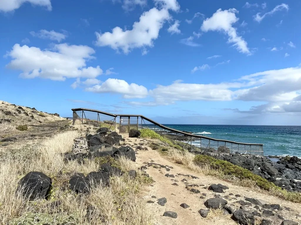
Distance 5.0 mi round trip · Elevation gain negligible · Easy–moderate · 3–4 h · Best: November–May · Free; end of paved road · Dogs: not allowed
At Oʻahu's far western tip, an old dirt road crosses a coastal plain of raised limestone reef and sand dunes to Kaʻena Point Natural Area Reserve. Native plants cover the dunes, and seabirds nest in burrows beside the path. Laysan albatross are most likely between November and May, Hawaiian monk seals often rest on the rocks, and humpbacks pass in winter.
Start from the Mokuleʻia (north) side; the Keawaʻula trail on the Waiʻanae side remains closed after storm damage. Go early and carry all your water; there's no shade.
Good to know: Open 6 a.m.–7 p.m., with no restrooms on the Mokuleʻia side. Stay at least 50 feet from monk seals and keep to marked paths. No dogs or drones.