
By Sebastian Frost, a mountain guide who has led hiking, climbing and mountain biking trips for three years. These trails are picked from ones I've guided or hiked.
TrailyMap, our website and app, puts more than 100,000 U.S. hiking trails on one map with hiker reviews and ratings, and for Sedona I've picked eight easy, beautiful ones, each about 2 miles round trip with under 400 feet of climbing. Expect arches, spires, a creek and a sunset knoll, all doable in a weekend. Go in spring or fall, and start early.
At a glance
Fay Canyon Trail, Coconino National Forest · 2.1 mi · easy · quiet box canyon with an arch most people miss
Boynton Vista Trail, Boynton Canyon · 1.1 mi · easy · short climb to the Kachina Woman spire
Birthing Cave via Long Canyon Trail, West Sedona · 2.0 mi · easy · a cliff alcove that frames the valley
Seven Sacred Pools via Soldier Pass Trail, West Sedona · 1.1 mi · easy · a giant sinkhole and stair-step rock pools
Sugarloaf Loop Trail, West Sedona · 1.9 mi · easy · small summit with views over the whole town
Airport View Trail, Airport Mesa · 1.4 mi · easy · 360-degree red-rock views and the sunset crowd
Red Rock Crossing, Crescent Moon Ranch · 1.9 mi · easy · Cathedral Rock above Oak Creek
Bell Rock Pathway loop, Village of Oak Creek · 1.8 mi · easy · flat circuit around Sedona's best-known butte
Quick picks
Best for first-timers: Bell Rock Pathway loop (#8)
Best for sunset: Airport View Trail (#6)
Best for kids: Seven Sacred Pools via Soldier Pass Trail (#4)
Best for a dog: Fay Canyon Trail (#1)
1. Fay Canyon Trail, Coconino National Forest
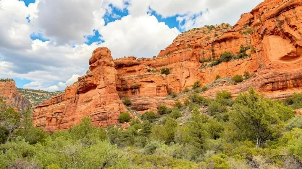
Distance 2.1 mi round trip · Elevation gain 144 ft · Easy · 1 hr · Best: spring and fall · Red Rock Pass to park · Dogs: on leash
Fay Canyon is a small box canyon off Boynton Pass Road. The sandy, mostly flat path winds through juniper and desert scrub while red cliffs close in on both sides. Its surprise is Fay Canyon Arch, a long sandstone span pressed so tightly against the east wall that many hikers walk right past it. The trail ends below a red cliff, where you turn around.
Watch for a cairned side path on your right; it climbs to the arch. It's short but steep and loose, so skip it if anyone in your group is unsteady. Shade is scarce, so from May to September aim to finish before noon.
Good to know: The large lot sits across the road from the trailhead and has vault toilets.
Map, GPX and directions on TrailyMap →
2. Boynton Vista Trail, Boynton Canyon
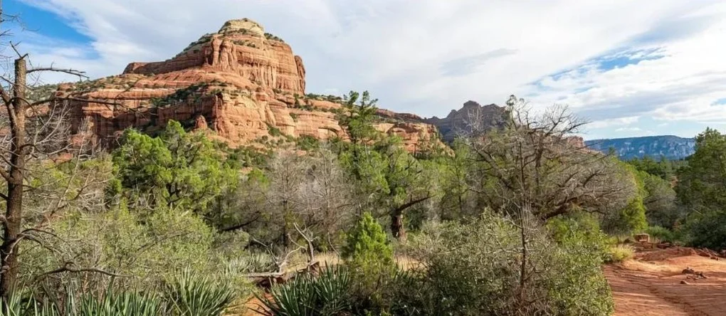
Distance 1.1 mi round trip · Elevation gain 135 ft · Easy · 30–45 min · Best: spring and fall · Red Rock Pass to park · Dogs: on leash
Think of this as the short version of Boynton Canyon. This spur near its start climbs gently past twisted junipers to a saddle beneath two rock spires, Kachina Woman and Warrior Rock. The saddle is one of Sedona's best-known vortex sites, and the view sweeps across red cliffs and buttes.
Start before 8 a.m. if you can. The Boynton Canyon lot is small, and the saddle gets busy once it fills. Wear shoes with good grip for the uneven rock near the top, and leave the stroller in the car.
Good to know: Bikes aren't allowed, and weekends are by far the busiest time.
Map, GPX and directions on TrailyMap →
3. Birthing Cave via Long Canyon Trail, West Sedona
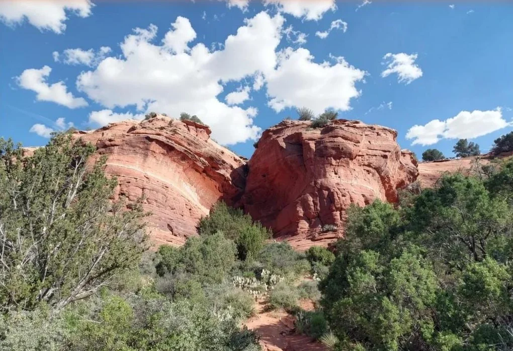
Distance 2.0 mi round trip · Elevation gain 292 ft · Easy · 1 hr · Best: fall through spring · No fee · Dogs: on leash
The approach couldn't be gentler: the wide, flat Long Canyon Trail. Then a side path heads for the cliffs and a smooth, rounded hollow in the rock face. Step inside and its curved walls frame juniper flats and distant red rock, which makes it one of Sedona's favorite photo spots.
About 0.6 mile in, go left at the junction; the main trail continues right and won't take you to the cave. The last stretch is a short, steep climb on a narrow path lined with cactus, so go slowly, especially coming down. The cave is shallow, and on busy mornings people take turns.
Good to know: Parking off Long Canyon Road is very limited. Arrive before about 7:30 a.m.; if it's full, pick another hike. Watch for mountain bikers on the first stretch.
Map, GPX and directions on TrailyMap →
4. Seven Sacred Pools via Soldier Pass Trail, West Sedona
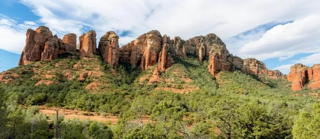
Distance 1.1 mi round trip · Elevation gain 108 ft · Easy · 30–45 min · Best: spring · No pass; shuttle advised · Dogs: on leash
One short walk, two big sights. First comes Devil's Kitchen, a huge collapsed sinkhole with crumbling red walls. About 0.4 mile farther are the Seven Sacred Pools, small basins worn into the sandstone that spill one into the next after rain. They look their best in April and May and can shrink to puddles by late summer.
Admire the pools from the rock beside them rather than wading in; wildlife depends on that water. Keep well back from the sinkhole's loose rim. Off-road Jeeps share the corridor near the start, so stay alert and step aside when one passes.
Good to know: The gated trailhead lot has just 14 spaces and is open 8 a.m.–6 p.m. Thursday through Sunday, the free Sedona Shuttle from the Posse Grounds park-and-ride is the easier option. Lot rules during shuttle hours have changed before, so check sedonashuttle.com.
Map, GPX and directions on TrailyMap →
5. Sugarloaf Loop Trail, West Sedona
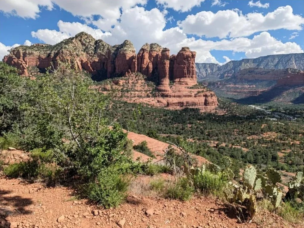
Distance 1.9 mi round trip · Elevation gain 354 ft · Easy · 1 hr · Best: year-round · No fee · Dogs: on leash
Right in the middle of West Sedona, this small red knob makes a good first-morning hike for getting your bearings. The loop around it shifts the view at every turn, and a short side climb to the top shows the whole town at once: rooftops and gardens below, big red formations rising behind them.
Signage is poor and unofficial paths cut across the loop, so download the track before you go. With only half an hour, skip the loop and walk straight up and back. Sunrise and early evening draw the most people; a weekday mid-morning is much quieter.
Good to know: The trailhead is off Buena Vista Drive in a residential neighborhood. Park only where it's signed and keep noise down early in the day.
Map, GPX and directions on TrailyMap →
6. Airport View Trail, Airport Mesa
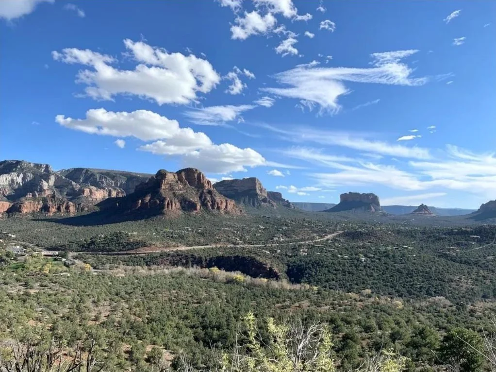
Distance 1.4 mi round trip · Elevation gain 243 ft · Easy · 30–60 min · Best: year-round · Paid airport lot (about $3) · Dogs: on leash
A flat-topped mesa rises in the middle of town, and this short trail crosses it to a vortex knoll with views in every direction: buttes, spires and the long line of cliffs to the north. Small planes take off and land behind you, which kids tend to love.
This is Sedona's classic sunset perch, so expect company at that hour. Arrive about 45 minutes early for parking and a seat, or come at sunrise for more room. The path is rocky and sometimes narrow, and the last rise is smooth rock with fencing to hold. Wear grippy shoes and carry a headlamp for the walk back.
Good to know: The small lot near the trailhead fills first. The backup is the paid lot at the airport, about $3, which may change.
Map, GPX and directions on TrailyMap →
7. Red Rock Crossing, Crescent Moon Ranch
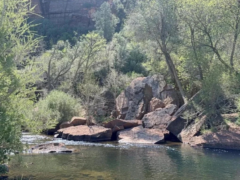
Distance 1.9 mi round trip · Elevation gain 52 ft · Easy · 30–60 min · Best: fall · Day-use fee (about $11) · Dogs: not allowed
For the least climbing on this list, come here, and you get Sedona's most famous view as a bonus. From the picnic area you walk down to Oak Creek under tall streamside trees, and Cathedral Rock rises above a calm stretch of water, often reflected in it.
The full route fords Oak Creek with no bridge, joins Baldwin Trail on the far bank, then crosses again onto Templeton Trail to reach the viewpoint. The water can be knee-deep, so pack wading sandals, and don't cross after storms. If the creek is high, stay on the near bank; Cathedral Rock still rises above the water.
Good to know: This concession-run site charges its own fee, and the Red Rock Pass doesn't count here. Confirm the fee and pet rule before you go. Oak Creek reopened in September 2026 after Pocket Fire closures.
Map, GPX and directions on TrailyMap →
8. Bell Rock Pathway loop, Village of Oak Creek
Distance 1.8 mi round trip · Elevation gain 203 ft · Easy · 30–60 min · Best: year-round · Red Rock Pass to park · Dogs: on leash
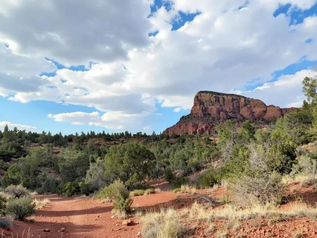
You've probably already seen Bell Rock from Highway 179. This loop circles the base of the bell-shaped butte on a wide, mostly flat path, with Courthouse Butte and Cathedral Rock in sight almost the whole way. The southern stretch gets the best late-afternoon light.
Climbing Bell Rock itself is optional. The lower ledges are fun, but higher up you need your hands on narrow sections, and that's where people get stuck. Stay on the loop and you won't miss any of the views. At the Phone Trail junction, keep left to return to the trailhead.
Good to know: The Bell Rock Vista lot fills fast. Thursday through Sunday, the free Sedona Shuttle runs from the SR 179 park-and-ride to Little Horse Trailhead, which links to Bell Rock Pathway by trail.